What is LiDAR?
LiDAR uses laser beams to scan an area or structure of interest. Millions of laser shots are emitted and recorded in the environment
This information is then analyzed on a computer to give an accurate 3D model of the area or structure of interest. The 3D model can then be manipulated to examine areas of concern. The manipulation includes rotating the model to view from various viewpoints and sectioning to look at specific locations. Measurements can be made in the model to provide a dimensional assessment of the facility. From this dimensional assessment, structure deformations and defects are visualized and the source of these deformations identified. For instance, measurements can be taken on a structure with rebar corrosion and concrete spalling from which wall or roof deformations may be seen and measured.
An initial scan and 3D model can be used as a baseline. With a subsequent scan at a later time, changes in dimensional characteristics can be measured by comparing the current scan with the initial scan. LiDAR provides the capability to take measurements where physical measurements would be difficult or impossible.

Technology to help visualize
LiDAR can be used to highlight deformations that aren’t visible to the naked eye
Case Study
In this case study Matergenics was called to perform a conditional assessment of a electric utility facility. During the assessment, Matergenics found a retaining wall which exhibited severe rebar corrosion and concrete spalling. In addition to the corrosivity measurements which were taken, Matergenics performed a LiDAR survey to establish a baseline of the wall’s condition as well as to perform an assessment of the wall using 3D modeling. With the 3D model of the wall, Matergenics could cut sections through the wall and inspect the wall for areas of distress or deformation. Figure 1 is a photo of the wall. Figure 2 is a 3D model from the LiDAR scan of the same wall.
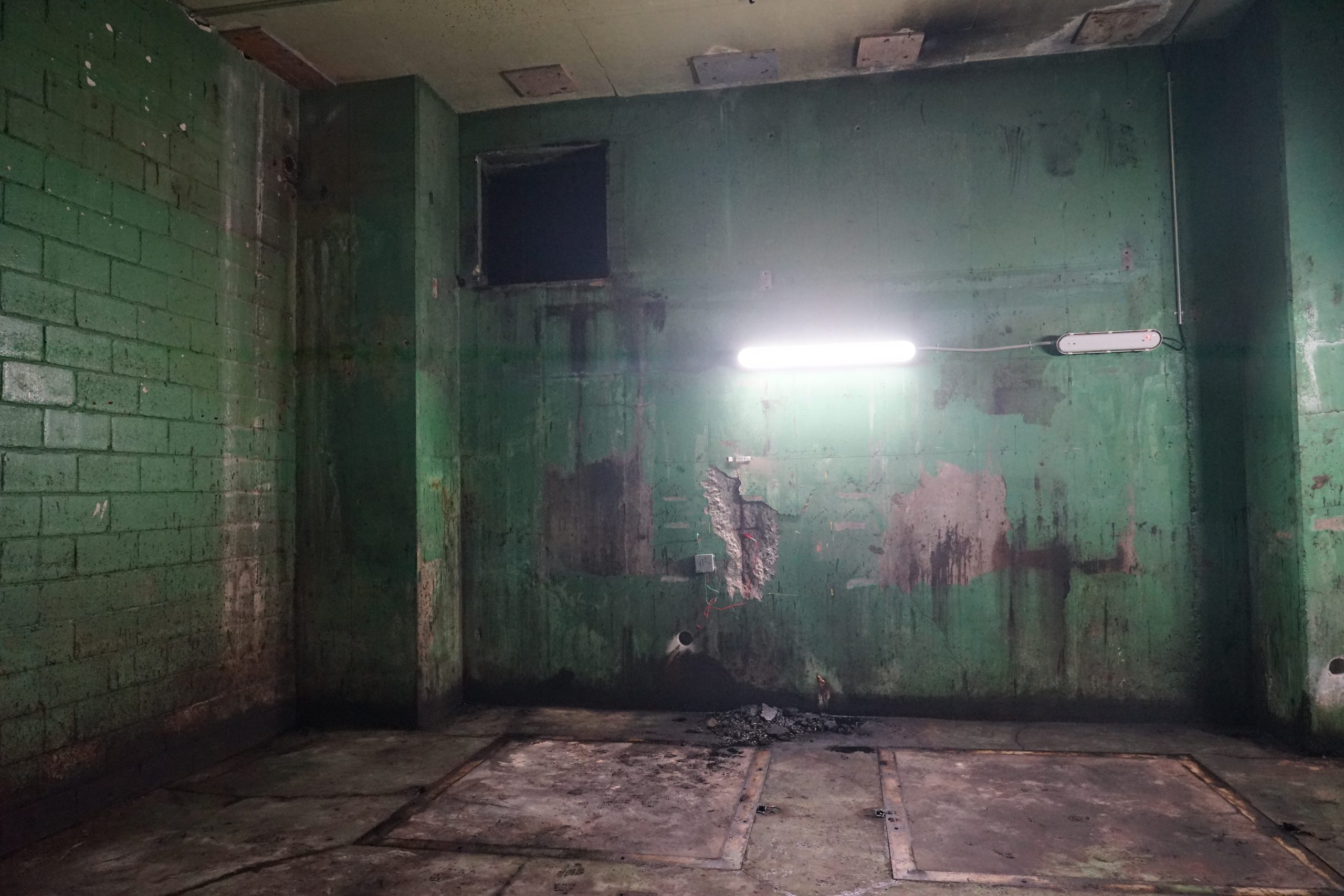
Figure 1: Photo of a Wall with Rebar Corrosion and Spalling

Figure 2: 3D Model of Wall from LiDAR Scan
Upon visual inspection of the wall, it was noted that the wall appeared to be deformed and bowed in an area halfway between the floor and ceiling. Measurement of the deformation would be very difficult using traditional methods. However, using the 3D LiDAR model, a section was cut through the middle of the wall and examined. In Figure 3, a section was cut through the middle of the wall and the model was then rotated such that it could be viewed vertically down. From this view the deformation or bow in the wall could be seen and measured. Based on the LiDAR model, the deformation was measured to be 2.5 inches. Subsequent to the conditional assessment of the wall, Matergenics performed a site survey and was able to determine the issues which caused the deterioration of the wall. Mitigation of those issues would prevent the wall from further deterioration.

Figure 3: Cross Section of the Wall Looking Vertically Down